

QGIS Server
With QGIS Server it is easy to publish QGIS desktop projects as identical WMS in the internet or intranet.
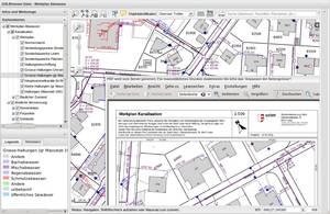
QGIS Server provides a web map service (WMS) using the same libraries as the QGIS desktop application. Maps and print templates created in QGIS desktop can be published as web maps simply by copying the QGIS project file into the server directory. The resulting web maps look exactly the same as in the desktop. QGIS Server is usually run as CGI/FastCGI module within the Apache Webserver.
QGIS Server also works as a WFS and WFS-T server. These services are easy to administer with QGIS Desktop. QGIS Server WFS supports all vector formats supported by QGIS.
Core Features
- Web Map Service (WMS)
- Web Feature Service (WFS)
- Edit WFS with WFS-T
- WYSIWYG card design with QGIS
- Sophisticated cartographic symbolization
- High quality cartographic printout
- Easy administration via QGIS Desktop
Implemented Standards
- OGC Web Map Service (WMS) 1.3.0
- OGC Web Feature Service (WFS) 1.0.0 und 1.1.0
- OGC Web Coverage Service (WCS) 1.1.1